Grid connection · England, United Kingdom
Burnt House Wind grid connection
Burnt House Wind grid connection is a grid connection in England, United Kingdom, with 6.32 MW of capacity, held by REG Burnthouse Limited.
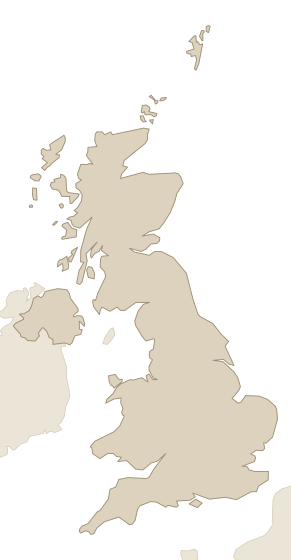
Facts
Every value links to its source, and to the source's own record where it has one. Licences and last-checked dates are per row.
| Fact | Value | Source |
|---|---|---|
| Location | England (connects at March Grid 33kV) | UK Power Networks open data portal · CC BY 4.0 · checked 25 Oct 2026 |
| Status | Operating (connected) | UK Power Networks open data portal · CC BY 4.0 · checked 25 Oct 2026 |
| Holder | REG Burnthouse Limited | UK Power Networks open data portal · CC BY 4.0 · checked 25 Oct 2026 |
| Attached to | Burnt House Farm (matched by name+coordinates+technology+capacity, 0.61 km away) | Rare Context entity resolution · CC0 1.0 · checked 25 Oct 2026 |
| Capacity | 6.32 MW | UK Power Networks open data portal · CC BY 4.0 · checked 25 Oct 2026 |
| Technology | Wind | UK Power Networks open data portal · CC BY 4.0 · checked 25 Oct 2026 |
| Grid operator | Eastern Power Networks plc (UK Power Networks, East England licence area) | UK Power Networks open data portal · CC BY 4.0 · checked 25 Oct 2026 |
| Connection date | 17 May 2013 | UK Power Networks open data portal · CC BY 4.0 · checked 25 Oct 2026 |
| Voltage | 33 kV | UK Power Networks open data portal · CC BY 4.0 · checked 25 Oct 2026 |
| Coordinates | 52.5361, -0.0219 | UK Power Networks open data portal · CC BY 4.0 · checked 25 Oct 2026 |
Research on this grid connection and its holder.Who holds it up to the parent company, the project behind it and its connection date, and an introduction to the holder.
Latest events
Dated events about this grid connection and the records linked to it from official notices, registers and owners' press releases, newest first. All recent changes.
- Commissioned: Burnt House Farm
- Permit granted: Burnt House Farm (planning authority Fenland, reference F/YR09/0392/F)
- Permit granted: Burnt House Farm (appeal granted, planning authority Fenland, reference F/YR09/0392/F)
- Permit refused: Burnt House Farm (planning authority Fenland, reference F/YR09/0392/F)
- Permit applied for: Burnt House Farm (planning authority Fenland, reference F/YR09/0392/F)
How it compares
Burnt House Wind grid connection is the 2,141st-largest of 3,539 grid connections in England and the 2,997th-largest of 4,870 in the United Kingdom by capacity; its 6.32 MW is <0.1% of the 467,981 MW we hold for the United Kingdom. Ranks and totals cover the grid connections in our data that report their capacity, not every one in existence.
| Within | Rank | Total | Share |
|---|---|---|---|
| England | 2,141st of 3,539 | 341,715 MW | <0.1% |
| United Kingdom | 2,997th of 4,870 | 467,981 MW | <0.1% |
| All grid connections in our data | 6,673rd of 8,618 | 1,355,288 MW | <0.1% |
Nearby
Within 50 km of this grid connection: 363 power plants (139 operating, 4,929 MW), 83 substations, 7 data centers and 3 transmission lines, measured from the coordinates in the facts above. The table shows the nearest 9, up to 3 per kind.
| Name | Kind | Size | Status | Distance |
|---|---|---|---|---|
| Turves Solar Farm | Power plant | 5 MW | Operating | 0.6 km |
| Burnt House Farm | Power plant | 6 MW | Operating | 0.6 km |
| Turves/Burtnhouse Solar Farm Extension | Power plant | 4.7 MW | Operating | 0.7 km |
| March Primary 11kV | Substation | — | — | 5.5 km |
| March Grid 33kV | Substation | — | — | 7.4 km |
| Positive Park | Data center | — | — | 7.5 km |
| Whittlesey Primary 11kV | Substation | — | — | 7.8 km |
| Data center, England (OSM way 87850427) | Data center | — | — | 16 km |
| Longmarsh Green Energy | Data center | — | Planned | 32 km |
Holder, grid operator and place
Other grid connections in England
- Bute Hydrogen Project 1 grid connection4,800 MW
- Drax BECCS grid connection3,906 MW
- Drax Power Station grid connection3,906 MW
- Bute Hydrogen Project 2 grid connection3,600 MW
- Bute Hydrogen Project 3 grid connection3,600 MW
- Bute Hydrogen Project 5 grid connection3,600 MW
- Bute Hydrogen Project 6 grid connection3,600 MW
- Hinkley Point C grid connection3,340 MW
Data on this page
- California ISO. CAISO queue report, CAISO Privacy and Terms of Use.
- Contains public sector information licensed under the Open Government Licence v3.0. DESNZ Renewable Energy Planning Database (REPD), Open Government Licence v3.0.
- SP Electricity North West, via Northern Powergrid Open Data. SP Electricity North West open data portal, CC BY 4.0.
- ERCOT GIS report. ERCOT GIS report, ERCOT Terms of Use.
- Supported by National Energy SO Open Data. NESO TEC Register, NESO Open Data Licence v1.0.
- Supported by Northern Powergrid Open Data. Northern Powergrid open data portal, Northern Powergrid Open Data Licence v1.0.
- NYISO interconnection queue. NYISO interconnection queue, Free reuse.
- © OpenStreetMap contributors. OpenStreetMap data centers, ODbL 1.0.
- Contains public sector information licensed under the Open Government Licence v3.0. Planning Inspectorate: National Infrastructure Projects, Open Government Licence v3.0.
- PJM New Services Queue. PJM New Services Queue, Free reuse.
- Rare Context entity resolution. Rare Context entity resolution, CC0 1.0.
- SP Energy Networks, via Northern Powergrid Open Data. SP Energy Networks open data portal, CC BY 4.0.
- SSEN Distribution. SSEN Distribution data portal, CC BY 4.0.
- UK Power Networks. UK Power Networks open data portal, CC BY 4.0.