Substation · England, United Kingdom
Thorpe Gd Local 11kV Substation
Thorpe Gd Local 11kV Substation is an 11 kV primary substation in England, United Kingdom, with 41.7 MVA of demand headroom and 103 MVA of generation headroom, operated by Eastern Power Networks plc (UK Power Networks, East England licence area).
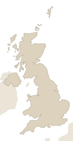
Facts
Every value links to its source, and to the source's own record where it has one. Licences and last-checked dates are per row.
| Fact | Value | Source |
|---|---|---|
| Location | England | UK Power Networks open data portal · CC BY 4.0 · checked 25 Oct 2026 |
| Grid operator | Eastern Power Networks plc (UK Power Networks, East England licence area) | UK Power Networks open data portal · CC BY 4.0 · checked 25 Oct 2026 |
| Demand headroom | 41.7 MVA | UK Power Networks open data portal · CC BY 4.0 · checked 25 Oct 2026 |
| Generation headroom | 103 MVA | UK Power Networks open data portal · CC BY 4.0 · checked 25 Oct 2026 |
| Firm capacity | 78 MVA | UK Power Networks open data portal · CC BY 4.0 · checked 25 Oct 2026 |
| Level | Primary substation | UK Power Networks open data portal · CC BY 4.0 · checked 25 Oct 2026 |
| Voltage | 11 kV | UK Power Networks open data portal · CC BY 4.0 · checked 25 Oct 2026 |
| Coordinates | 52.6216, 1.3197 | UK Power Networks open data portal · CC BY 4.0 · checked 25 Oct 2026 |
Research on this substation and the land around it.Its headroom, connection queue and congestion, who owns the land around it, and an introduction to those owners.
Nearby
Within 50 km of this substation: 205 power plants (69 operating, 2,324 MW), 141 grid connections (93 operating, 1,670 MW) and 2 transmission lines, measured from the coordinates in the facts above. The table shows the nearest 8, up to 3 per kind.
| Name | Kind | Size | Status | Distance |
|---|---|---|---|---|
| Battery storage 150 MW grid connection at Norwich | Grid connection | 150 MW | Planned | 0.9 km |
| Crown Point grid connection | Grid connection | 228 MW | Planned | 1.7 km |
| Trowse Solar Farm grid connection | Grid connection | 5 MW | Operating | 1.9 km |
| Land East of White Horse Lane | Power plant | 5 MW | Operating | 1.9 km |
| White Horse Lane (Trowse) - Phase 2 | Power plant | 9 MW | Cancelled | 1.9 km |
| Mulbarton Road, Keswick - Battery Energy Storage System | Power plant | 400 MW | Planned | 3.9 km |
| Norwich to Tilbury | Transmission line | — | Planned | 6.2 km |
| LionLink Interconnector | Transmission line | — | Planned | 49 km |
Grid operator and place
Grid connections attached to this substation
More from Eastern Power Networks plc
- Canvey Primary 11kVsubstation
- Thorley Primary 11kVsubstation
- Peterborough South Grid 11kVsubstation
- Westbury Primary 11kVsubstation
- Laxfield Primary 11kVsubstation
- Fulbourn Grid 33kVsubstation
- Earlham Grid 33kVsubstation
- Hunstanton Primary 11kVsubstation
Candidate sites around this substation
11 sites of land near Thorpe Gd Local 11kV have it as nearest substation. Each site page gives its area, its distance to the substation and its site score; owners are on request.
- 6.92 ha brownfield site at Utilities Site, Cremorne Lane, Norwich0.01 km · score 70
- 16 ha brownfield site at Deal Ground, Bracondale, Norwich0.46 km · score 66
- 20 ha brownfield site at Carrow Works, Norwich0.63 km · score 65
- 4.49 ha brownfield site at Utilities Site, Norwich0.31 km · score 65
- 4.64 ha brownfield site at Site of ATB Laurence Scott, Kerrison Road/Hardy Road, Norwich NR1 1JN0.37 km · score 64
- 3.24 ha brownfield site at Land adjoining Norwich City Football Club (incl Groundsmans Hut and…0.58 km · score 61
- 2.78 ha brownfield site at May Gurney & Keir site & Carrow Yacht Club, Trowse, Norwich0.67 km · score 60
- 1 ha brownfield site at Land at Lower Clarence Road, Norwich0.7 km · score 60
- 1.01 ha brownfield site at Thorpe Lodge, 1 Yarmouth Road, Thorpe St Andrew, Broadland0.81 km · score 58
- 1.52 ha brownfield site at Norwich Mail Centre, 13-17 Thorpe Road, Norwich NR1 1AA0.84 km · score 57
- 1.09 ha brownfield site at Ailwyn Hall Lower Clarence Road Norwich NR1 1HD0.94 km · score 56
Other substations in England
Data on this page
- Contains public sector information licensed under the Open Government Licence v3.0. DESNZ Renewable Energy Planning Database (REPD), Open Government Licence v3.0.
- Contains public sector information licensed under the Open Government Licence v3.0. Planning Inspectorate: National Infrastructure Projects, Open Government Licence v3.0.
- UK Power Networks. UK Power Networks open data portal, CC BY 4.0.