Substation · England, United Kingdom
Stewarts Rd 11kV Substation
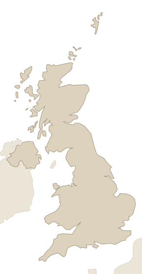
Stewarts Rd 11kV Substation is an 11 kV primary substation in England, United Kingdom, with 77.8 MVA of demand headroom and 102 MVA of generation headroom, operated by London Power Networks plc (UK Power Networks, London licence area).
Facts
Every value links to its source, and to the source's own record where it has one. Licences and last-checked dates are per row.
| Fact | Value | Source |
|---|---|---|
| Location | England | UK Power Networks open data portal · CC BY 4.0 · checked 25 Oct 2026 |
| Grid operator | London Power Networks plc (UK Power Networks, London licence area) | UK Power Networks open data portal · CC BY 4.0 · checked 25 Oct 2026 |
| Demand headroom | 77.8 MVA | UK Power Networks open data portal · CC BY 4.0 · checked 25 Oct 2026 |
| Generation headroom | 102 MVA | UK Power Networks open data portal · CC BY 4.0 · checked 25 Oct 2026 |
| Firm capacity | 86.5 MVA | UK Power Networks open data portal · CC BY 4.0 · checked 25 Oct 2026 |
| Level | Primary substation | UK Power Networks open data portal · CC BY 4.0 · checked 25 Oct 2026 |
| Voltage | 11 kV | UK Power Networks open data portal · CC BY 4.0 · checked 25 Oct 2026 |
| Coordinates | 51.4759, -0.1419 | UK Power Networks open data portal · CC BY 4.0 · checked 25 Oct 2026 |
Research on this substation and the land around it.Its headroom, connection queue and congestion, who owns the land around it, and an introduction to those owners.
Nearby
Within 50 km of this substation: 351 power plants (132 operating, 4,307 MW), 350 grid connections (253 operating, 2,323 MW), 147 data centers (1 operating, 88 MW), 1 transmission line and 1 AI supercomputer, measured from the coordinates in the facts above. The table shows the nearest 9, up to 3 per kind.
| Name | Kind | Size | Status | Distance |
|---|---|---|---|---|
| Battersea Development grid connection | Grid connection | 4 MW | Operating | 0.7 km |
| Gas 2.48 MW grid connection at Ebury Bridge 11kV | Grid connection | 2.48 MW | Operating | 1.1 km |
| WRN Broadcast | Data center | — | — | 1.3 km |
| Oil 2.92 MW grid connection at Victoria St 11kV | Grid connection | 2.92 MW | Operating | 2.4 km |
| Pegasus House, Sackville Street - Roof Mounted Solar Panels | Power plant | 2.3 MW | Cancelled | 3.8 km |
| Visa London | Data center | — | — | 5.5 km |
| Verne Global London Data Centre | Data center | — | — | 6.0 km |
| Westfield London Shopping Centre, Ariel Way - Solar Panels | Power plant | 1 MW | Planned | 6.4 km |
| SELCHP | Power plant | 35.5 MW | Operating | 6.8 km |
Grid operator and place
Grid connections attached to this substation
More from London Power Networks plc
- Leicester Sq 11kVsubstation
- Ley St B 11kVsubstation
- Deptford Grid 11kVsubstation
- Aberdeen Pl B 11kVsubstation
- Farjeon Rd 11kVsubstation
- Shorts Gdns 11kVsubstation
- Crayford 11kVsubstation
- Chislehurst 11kVsubstation
Candidate sites around this substation
10 sites of land near Stewarts Rd 11kV have it as nearest substation. Each site page gives its area, its distance to the substation and its site score; owners are on request.
- 25 ha brownfield site at New Covent Garden Market, Nine Elms Lane (Combined Main Market…, Wandsworth0.52 km · score 68
- 1.06 ha brownfield site at Battersea Park Road (between Stewarts Road and Thessally road), Wandsworth0.34 km · score 65
- 15 ha brownfield site at South Lambeth Goods Depot, Cringle St./Battersea Park Rd., Kirtling…, Wandsworth0.67 km · score 63
- 2.81 ha brownfield site at Westbury Estate, Lambeth0.62 km · score 61
- 5.23 ha brownfield site at Royal Mail Group Site, Ponton Road (Nine Elms Parkside), Wandsworth0.7 km · score 60
- 1.27 ha brownfield site at Marco Polo House 346 Queenstown Road (Vista, Chelsea Bridge), Wandsworth0.66 km · score 60
- 2.1 ha brownfield site at Tideway Industrial Estate 87 Kirtling Street (Riverlight), Wandsworth0.74 km · score 59
- 1.13 ha brownfield site at Cringle Dock, Nine Elms, SW8, Wandsworth0.71 km · score 59
- 1.01 ha brownfield site at 259-311 Battersea Park Road, SW 11 (Doddington Estate part)), Wandsworth0.82 km · score 58
- 1.91 ha brownfield site at Hemans Estate, Lambeth0.86 km · score 57
Other substations in England
Data on this page
- Contains public sector information licensed under the Open Government Licence v3.0. DUKES 5.11: Power stations in the United Kingdom, Open Government Licence v3.0.
- Contains public sector information licensed under the Open Government Licence v3.0. DESNZ Renewable Energy Planning Database (REPD), Open Government Licence v3.0.
- © OpenStreetMap contributors. OpenStreetMap data centers, ODbL 1.0.
- UK Power Networks. UK Power Networks open data portal, CC BY 4.0.